Stupid Geo Tricks
For Python* Developers
*(or Python-friendly)make your dev-life better
with geojson
- good for web
- good for interchange
- yay, standards
A Pythonista's BFF: __geo_interface__
- JSONify spatial objects
- Community standard
- Implemented by all your favorite libraries
With __geo_interface__ in your toolbox, as long as you can read spatial data, you can write GeoJSON
import shapefile

def features(data):
  sf = shapefile.Reader(data)
  fields = sf.fields[1:]
  field_names = [field[0] for field in fields]

  for r in sf.shapeRecords():
    attr = dict(zip(field_names, r.record))
    geom = r.shape.__geo_interface__
    yield dict(geometry=geom, properties=attr)
>>> my_features = features(my_awesome_shapefile.shp)
>>> my_features.next()
# start with a shapefile, end with a geoJSON representation of each feature
*for practical purposes, in 10.2+ only
Python + pipelines
for fun & profit
	$ cat my_awesome_document.txt | wc -l

	# returns number of lines in my_awesome_document.txt
(Feel free to just smile & nod here)
	$ fio cat my_awesome_shapefile.shp | wc -l

	# returns number of spatial features in my_awesome_shapefile.shp
WAT.

MORE MAGIC
	$ fio cat my_red_shapefile.shp my_blue_shapefile.shp \
	  | fio load my_purple_shapefile.shp
	$ fio cat boring_shapefile.shp | magical_geoprocessing_script.py \
	  | fio load shiny_new_shapefile.shp
What is that?!
Python library fiona's built-in CLI "fio"
fio's
cat works like unix-y cat, with added
spatial goodness
(For the raster nerds, check out Rasterio, which has a CLI "rio")
Version control: just do it
Why?
You're a developer. You use source control already*.Stick spatial data in a repo for the same reason you do it to your code.
*(right?)
How:
Git for shapefiles & databases.
	$ geogig init
	$ geogig import my_awesome_shapefile.shp
	$ geogig add
	$ geogig commit -m "initial commit"
	$ geogig status
	  On branch master
	  # blah blah etc...
	  # basically the git we all know & love... PLUS SPATIAL.
MORE MAGIC:
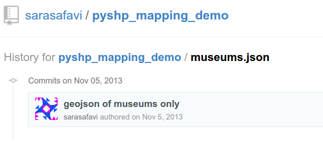
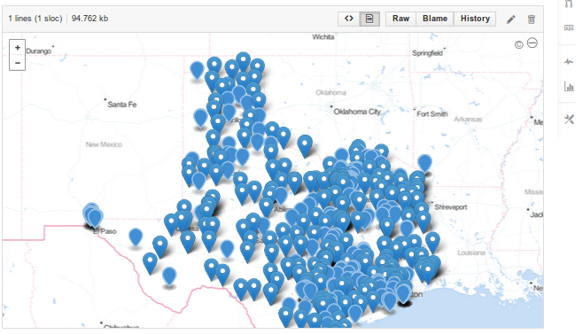
GeoJSON + GitHub
- Push a GeoJSON file to GitHub.
- View your GeoJSON file on GitHub.
- There is no step three.
Good:
track data's history
Better:
Maps rendered automagically
Best:
Spatial diffs on GitHub
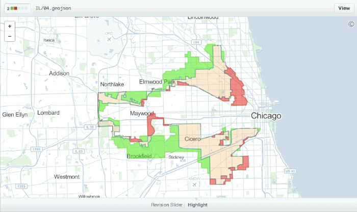
omgwtf github are you a wizard